Difficulty: 3/5
Hiking Distance: 4 - 13 km
Time: 1-2 Days
Elevation Gain: 220m - 610m
Prefecture: Kumamoto

阿蘇山
A complete guide to hiking Mt. Aso
Elevation: 1592m
Prefecture
Kumamoto
Trails
3
Distance
4km - 13km
Elevation Gain
220m - 610m
Time
3 - 7 hours
Difficulty
3/5
Accommodation
Camping & Ryokans
Overview
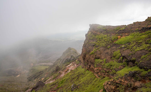
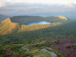
Mt. Aso is an active volcano located in the centre of Kyushu, near the city of Kumamoto. It's the largest active volcano in Japan and one of the largest in the world. It features numerous mountains with hiking trails and a variety of beautiful terrain with stunning views. The highest peak in the area is Taka-dake (on the Naka-dake trail) which overlooks the active caldera and is often closed when volcanic gas levels become too high.
The Mt. Aso area consists of five main peaks: Naka-dake, Taka-dake, Eboshi-dake, Kishima-dake, and Neko-dake. The 3 main hikes accessible from the bus area can be done over two days and will cover 4 out of the 5 peaks. Naka-dake and Taka-dake are part of the same hike and will take about 5 hours, while Eboshi-dake and Kishima-dake will only take a few hours to complete. The 5th peak, Neko-dake, is only accessible with a car. It's a nice fun hike but if your time is limited then it's not worth the detour as Kyushu is full of many amazing mountains to explore.
There is also a beautiful little conical volcano called Komezuka, it's off-limits for hikers but there are many great viewpoints of Komezuka along the Kishima-dake trail.
Access
Car - If you're using a car, you can park directly at the museum or ropeway parking lots, the museum parking will cost ¥500, but parking at the observation deck above the museum is free. The ropeway has both paid and free parking.
From the museum, you can access the trails for Eboshi-dake and Kishima-dake.
From the ropeway, you can access the crater and Naka-dake.
Train + Bus - If going by public transport then you'll need to reach Kumamoto station or Beppu station, from there you can catch a bus or train bound for Aso station, this takes 1.5 to 2 hours and will cost around ¥1500, google maps will provide accurate info for these options. A shuttle bus runs from Aso station into the park, taking about 30 mins and costing ¥650. Here's a link for the bus timetable and access info on the official Aso website.
Osaka/Kyoto and Tokyo:
Flights to Kumamoto are relatively cheap, ranging from $70 to $130 USD one-way, check Skyscanner for the best options.
The overnight ferry is the best option, available from Osaka to Beppu, and Tokyo to Fukuoka. Prices start from about ¥8000 and increase if you want a nicer room or if you're travelling during holidays. The ferry is very nice, a lot of fun, and is an experience in itself. Click here for Osaka, or here for Tokyo.
There is an overnight bus from Kyoto and Osaka to Fukuoka, Kumamoto, and Beppu, it takes 10 to 12 hours and the price varies from ¥4000 to ¥10,000, with Fukuoka being the cheapest option. Click here for the bus to Fukuoka, here for the bus to Kumamoto, or here for the bus to Beppu.
Weather and Seasons
May to September are the best times for hiking in Aso, summer will give you lush green scenery and the peak autumn colours occur in the second half of October. There is a lot of rain during summer, with June and July receiving the most rain, it's nice and warm with an average high of 29°C. Keep an eye on the forecast for possible typhoons, which peak in August and September. Winter hiking is also possible, with snowfall occurring from December to March.
Maps
Useful links

Kishima-dake and Ojo-dake
杵島岳
Elevation: 1326m
Trail Description
Time: 3 hrs
Distance: 5.5km
Elevation change: ➚450m gain ➘450m loss
Starting from the museum, the Kishima-dake trail is a popular short hike with panoramic views of the Naka-dake crater, Eboshi-dake, and the iconic Komezuka volcano. The adjoining trail to Ojo-dake offers equally beautiful and unique scenery with less people, so it's a perfect spot to bring your lunch. The sunrise and sunset from these two peaks is exceptionally beautiful and the terrain is easy to hike. If you are tempted to take the loop trail around the crater connected to Kishima-dake, note that it can become quite overgrown in August/September.
For a full day of hiking you can continue to Eboshi-dake once you get back to the start of the trail.

Elevation Profile

Gallery


烏帽子岳
Eboshi-dake
Elevation: 1337m
Trail Description
Time: 2-3 hrs
Distance: 4 km
Elevation change: ➚220m gain ➘220m loss
Also starting from the museum, the Eboshi-dake trail is a nice easy hike that takes you around the Kusasenri grassland plateau where horses and cows graze peacefully. The views from the top are stunning and you can clearly see the Naka-dake crater viewing area and Kishima-dake. As it's quite a short hike, you can combine it with the Kishima-dake trail or the Naka-dake trail.
In summer, the Kusasenri plateau also offers horseback riding.

Elevation Profile

Gallery


中岳
Naka-dake
Elevation: 1506m
Trail Description
Time: 5 hrs
Distance: 12.5 km
Elevation change: ➚610m gain ➘610m loss
Naka-dake and Taka-dake are the highest peaks in the Aso caldera, with Naka-dake towing above the smouldering crater where evacuations are common due to the constant presence of volcanic gas. The views are dramatic and stunning, and the terrain is unique and beautiful. Check the current status of the crater here before attempting to hike this trail - some volcanic gases are invisible and odourless and if you hike it while it's closed you will experience breathing difficulties which could become severe. You can read about the health effects of volcanic gas exposure here.
The trail begins from the start of a small ropeway, the carpark opens from 8:30am. The trail goes past the crater viewing area and then continues up to the volcanic peaks. It will take about 2 hours to get to the Naka-dake peak where you will find the best views. Loop around the neighbouring Taka-dake peak and then continue back down the way you came.
If you're using the bus, make sure you know the last bus departure time before you start hiking as you won't be able to stay for sunset.


Elevation Profile
Gallery

Related Articles


