Difficulty: 3/5
Hiking Distance: 9.2km
Time: 6-8 hours
Elevation gain: 1210m
Prefecture: Tochigi

男体山
Mt. Nantai, Nikko
Elevation: 2486m
Prefecture
Tochigi
Elevation Gain
1210 m
Distance
9 km
Time
6-7 hours
Difficulty
3/5
Accommodation
Hotels & Campgrounds
Overview
Mt Nantai is a magnificent volcano rising up from Lake Chuzenji. It's one of the best hikes in Nikko National Park and listed as one of Japan's Hyakumeizan (Japan's 100 famous mountains). It is a relatively short but steep climb that first begins in the forest, then transitions into large boulders and rocks, and ends with rich volcanic gravel. The views at the top are amazing, it also holds a small UNESCO listed shrine.
Aside from Mt. Nantai, Nikko National Park is an incredible collection of mountains, lakes, temples, and shrines. You could easily spend 3 to 4 days hanging out here and exploring the area. Some of the most notable attractions include the incredible Kegon Waterfall, the lavishly decorated Toshogu Shrine, and the Mt. Hangetsu Observation Deck.
Access
Car
The trailhead is located at a shrine which has limited parking, but there are plenty of parking lots within walking distance. If you're planning to drive here on the weekend, prepare for a lot of traffic. The roads around Nikko are stunning, so it might be worth taking a day off to avoid the weekend crowds if you prefer to drive.
Train & Bus
The town of Nikko is a good base for entering the national park, there is an efficient bus system that runs from the town, and a direct train from Tokyo that takes two hours. The bus from Nikko town to Lake Chuzenji takes about 45 mins to 1 hour depending on traffic. From there you will find another bus that will take you to the shrine where the trailhead begins, this takes about 10 mins.
For public transport I recommend getting the Nikko all-area pass (4,780 yen), available from the TOBU Info Center in Asakusa, it includes a 20% discount on limited express train tickets, and unlimited bus rides inside the park. If taking the cheaper local trains or driving, you can just buy a bus pass from the tourist info centre at Nikko station (2,650 yen) which gives you unlimited rides into the national park.
Tokyo: Nikko station is 2 hours from Asakusa in Tokyo and the train costs about ¥3000. Or you can catch the local trains with 1 or 2 connections and save about ¥1000 for an extra half hour of travel time. You can also catch local trains from Shinjuku for about ¥2000.
Trailhead: Google Maps
Crowds: During autumn (Sep/Oct) and on long weekends, crowds in Nikko can be pretty intense. The traffic can also become very congested, sometimes doubling the travel time by both car and bus.
Note: Access to the trailhead is managed by the Chugushi Shrine and requires a ¥1000 entry fee. They also forbid any hiking from November 11 to April 25.
Maps

Useful links
Weather and Seasons
The hiking season is from May to October, snow will hang around until May and begins falling again in October. The summer weather is beautiful and about 8 degrees cooler than in Tokyo, although rain is quite common. The autumn leaves reach their peak around the end of September, which is also the busiest time of year.
Sleeping
Hotels in Nikko can get booked out pretty fast, so it's best to book early, the best prices are usually found on booking.com. You can also get an extra discount using this coupon.
If you prefer camping, there's a campsite right on the lake, located here.
Trail Description
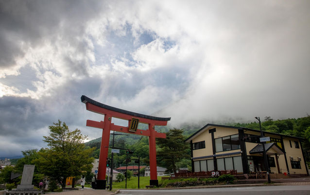
The trailhead starts at the Futarasan Chugushi Shrine and you'll need to pay ¥1000 to enter as the mountain is considered part of the shrine. The trail begins in a nice forest and meanders its way up the mountain, after about 20 minutes you will reach a road, keep an eye out for a small trail on the left which bypasses the first section of the road. The road doesn't last long and soon you will be back in the forest, the trail gets steeper from here.
The trail is well-marked so you won't need a detailed description, after about 2 hours you will reach a rocky section with large boulders which can be quite fun to climb. Eventually you'll come across red volcanic rocks and scree which marks the final stretch to the summit.

Elevation Profile
Cautions
Altitude (weather)
Monkeys
Bears (rare)
Gallery

Difficulty: 3/5
Hiking Distance: 9 km
Time: 6-7 hrs
Elevation gain: 1210m
Prefecture: Tochigi
Related Articles


